geo3D.
![]()
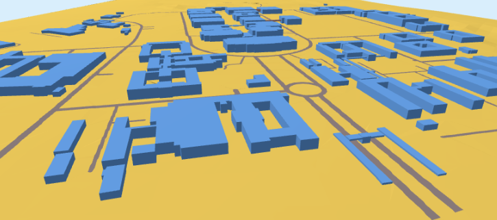
3D City Models for Geography and Sustainable Development Education.
geo3D is a python-based workflow to facilitate high school and tertiary level learning.
The purpose of this work aims to enrich geography and sustainable development education through a constructivist approach. We drive engagement and participation by giving students the ability to create affordable, high-quality 3D City Models and using these as learning tools.
There are two processing options
| Village | Suburb |
|---|---|
| If your Area-of-Interest (aoi) has less than 2 500 buildings, you are welcome to choose village | Please choose suburb if your aoi has more than 2 500 buildings |
Within each processing option; there are two strategies
| osm_LoD1_3DCityModel | InteractiveOnly |
|---|---|
| If you need a topologically correct LoD1 3D City Model please choose osm_LoD1_3DCityModel-walkthrough | Please choose InteractiveOnly if you do not need a LoD1 3D City Model. |
The primary product is a topologically correct Level of Detail 1 (LoD1) 3D City Model*. Secondary products include an application of spatial data science and an HTML-based visualization. Our mission is to empower high school learning and community engagement by fostering effective communication and advocacy at the grassroots level.
Please see the Discussion.
* the goal is a Open Geospatial Consortium (OGC) standard model that conforms to the ISO 19107 spatial schema for 3D primatives [connecting and planar surfaces, correct orientation of the surfaces and watertight volumes] I have not tested this for all possibilities. If the result you achieve is not; you are welcome to raise an issue. I depend on you to help me improve.