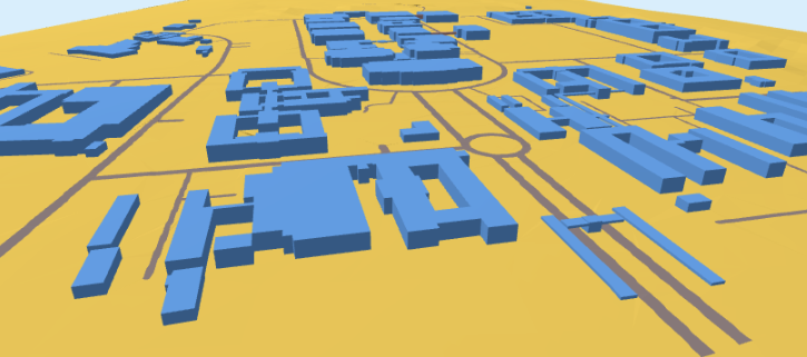
Level-of-Detail 1 (LoD1) 3D City Models
osm_LoD1_3DCityModel is a python-based workflow for the creation of LoD1 3D City Models (buildings and terrain) from OpenStreetMap (osm) contributions with elevation from a raster Digital Elevation Model (DEM). The workflow aims for simplicity.
It takes 2D osm vector contributions (building outlines) with building:level tagged and extrudes the polygon from the DEM (terrain).
There are two procesing strategies
| Village/Campus | District [This is on hold] |
|---|---|
| If your Area-of-Interest (aoi) has less than 2 500 buildings you are welcome to choose village/campus | Please choose districts if your aoi has more than 2 500 buildings. |
The purpose of this work is to provide resource constrained communities with an array of high-quality 3D products—at a much lower cost. Its participatory nature seeks to enable effective communication, community advocacy and facilitate broadly-based decision-making processes at a grassroots level.
The tool can also be customized to meet basic education (citizen science, geography and coding) needs. Please see the Discussion.
Input a raster DEM. Script will call for the osm contributions.
Output includes:
i. a topologically correct LoD1 City Model (information rich building models seperate from the ground; but when connected to the terrain form a water-tight surface*);
ii. one use case of 3D city models. Population estimation and the calculation of Building Volume per Capita; and
iii. an interactive .html which you can navigate, query and share.
* the goal is a model that conforms to the ISO 19107 standard [connecting and planar surfaces, correct orientation of the surfaces and watertight volumes] I have not tested this for all possibilities. If the result you achieve is not; you are welcome to raise an issue. I depend on you to help me improve.