What does it do?
Table of contents
Extrusion
An extremely well documented method of producing 3D Models is through extrusion. With extrusion; 2D features are lifted from an existing surface creating a volumetric 3D object. osm_LoD1_3DCityModel inferes the height with which to lift 2D features from osm contributions.
The osm tag building:level is taken as a proxy for the height of a building. The calculation is simply building:level * 2.8 + 1.3. If a structure does not have a building:level tag no LoD1 model is created.
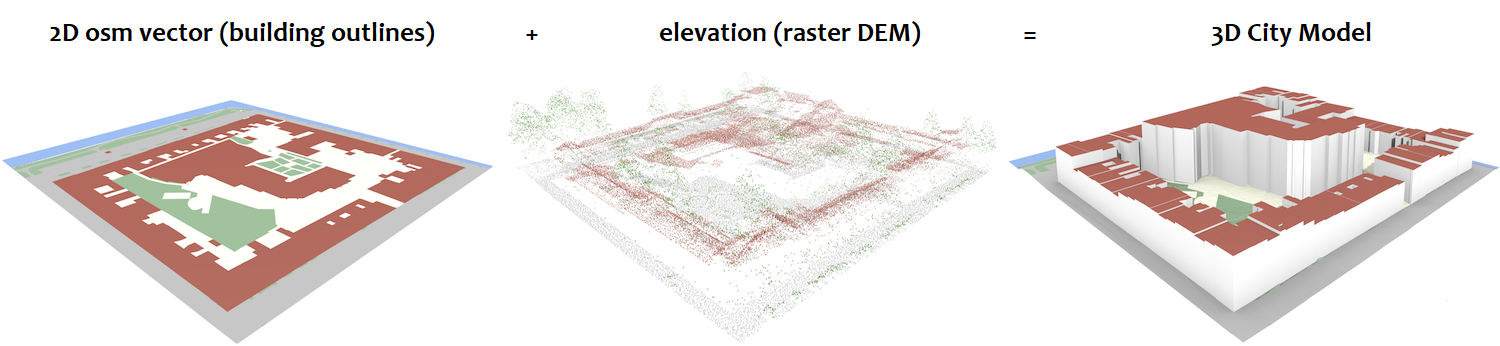
osm_LoD1_3DCityModel process. --image adapted from 3dfier by the 3D geoinformation research group at TU Delft.Fig 1 illustrates the process where the osm proxy building:level height is added to the raster DEM to create a 3D topologically connected surface ~ containing 2D polygons as 3D objects.
osm_LoD1_3DCityModel products
Solids
Solid objects are walls, floors and rooves stored as rectangular faces. In the CityJSON format these are Building City Ojects separate from the TINRelief.
Interactive Visualisation with Spatial Data Science
A dynamic visualisation and spatial analysis is possible through a Jupyter notebook. Interactive Visualization discusses this further.
Is it useful?
The LoD1 City Model, while basic, offers many advantages over 2D datasets. These may be used for shadow analyses, line of sight predictions and advanced flood simulation.
As the CityJSONspatialDataScience.ipynb illustrates population estimation and the calculation of Building Volume per Capita (Ghosh, T.; et. al.) are also possible.
With the coming revolution in air traffic control, to accommodate newer forms of air services (delivery drones and urban air mobility), an accurate digital representation of the built environment will become crucial. A 3D City Model is one component for the effective air space management of the future.
Challenges do exist. Of primary concern are errors in the source data that propagate to the generated 3D model. Care must be taken to ensure the quality of both the vector building outlines and raster DEM.